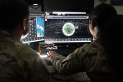
U.S. Space Force Guardians assigned to Space Delta 5 monitor computer workstations Dec. 18, 2025, at Vandenberg Space Force Base, Calif. (Photo by David Dozoretz)
Lt. Gen. Gregory Gagnon provided new details about how Space Force guardians supported the joint force during Operation Midnight Hammer and Operation Absolute Resolve.
WASHINGTON, DC – JULY 15: Sen. Maggie Hassan (D-NH) gives a statement after a policy luncheon with Democratic senators at the U.S. Capitol on July 15, 2025 in Washington, DC. (Photo by Michael M. Santiago/Getty Images)
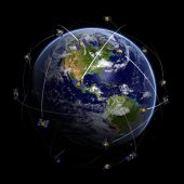
Sen. Maggie Hassan told DefenseScoop that she aims to help “lay the groundwork for the next generation of position, navigation, and timing systems that will keep us…
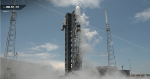
The mission was executed just three months after the Space Force notified industry to prepare for liftoff, the second time the service has launched a GPS III…
White Sands, N.M. (February 09, 2020) — Naval Information Warfare Center (NIWC) Atlantic engineers travelled to New Mexico to validated M-code on Joint Light Tactical Vehicle test platforms like the ones pictured here, resulting in the Marine Corps obtaining U.S. Space Force certification for next-generation GPS technology. (U.S. Navy photo by Joe Bullinger/Released)
Secretary of the Air Force Frank Kendall testifies before the Senate Appropriations Committee on the fiscal year 2025 budget requests for the Department of the Air Force and Space Force, Dirksen Senate Office Building, Washington, D.C., April 9, 2024. (U.S. Air Force photo by Andy Morataya)
The new Quick Start rapid acquisition authority allows the Air Force and other services to begin development on new programs without a congressionally approved budget.
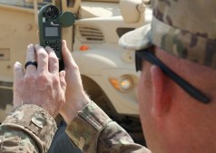
Sgt. 1st Class Jeffrey Englehardt, the noncommissioned officer-in-charge of the operations section for the 142nd Combat Sustainment Support Battalion, which is deployed to support 1st Theater Sustainment Command, gauges wind speed near the Camp Buehring, Kuwait, drop zone for the April 22, 2021 air drop of four bundles using the Joint Precision Air Delivery System, JPADS. Englehardt said JPADS uses the Modular Autonomous Guidance Unit, or MAGU, to manipulate the the parafoil’s rigging to steer it using GPS to reach its programmed coordinates. (U.S. Army photo by Staff Sgt. Neil W. McCabe)
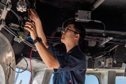
Electronics Technician 2nd Class Eric Wang, from Irvine, Calif., conducts maintenance on the global positioning system in the pilot house aboard Independence-variant littoral combat ship USS Charleston (LCS 18). (U.S. Navy photo by Mass Communication Specialist 2nd Class Ryan M. Breeden)
According to an RFI, the Navy is looking for technical, engineering and scientific expertise and capabilities that can support the lab’s work related to space-based position, navigation…
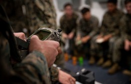
U.S. Marine Corps combat engineers attached to Battalion Landing Team 3/5, 31st Marine Expeditionary Unit (MEU), utilize a GPS during an Instrument Set, Reconnaissance and Surveying (ENFIRE) class aboard the amphibious assault ship USS America (LHA 6) in the Philippine Sea, July 6, 2021. (U.S. Marine Corps photo by Cpl. Karis Mattingly)
The events that have unfolded over the last year in Ukraine have shown the need to accelerate the fielding of new technologies like GPS alternatives and other…
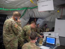
A U.S. Army Multi Domain Task Force operates from the Tactical Command Post as a part of their premier appearance at Valiant Shield 2018 Sept. 20, 2018. (U.S. Navy photo by Mass Communication Specialist 1st Class Danica M. Sirmans)