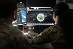
U.S. Space Force Guardians assigned to Space Delta 5 monitor computer workstations Dec. 18, 2025, at Vandenberg Space Force Base, Calif. (Photo by David Dozoretz)
Along with four new portfolio acquisition executives announced Tuesday, the Space Force is in the process of establishing three additional organizations, according to Tom Ainsworth.
U.S. Space Force Guardians assigned to Space Delta 5 monitor computer workstations Dec. 18, 2025, at Vandenberg Space Force Base, Calif. (Photo by David Dozoretz)
Lt. Gen. Gregory Gagnon provided new details about how Space Force guardians supported the joint force during Operation Midnight Hammer and Operation Absolute Resolve.
SDA was looking to build out PNT capabilities in the Tranche 3 transport layer of the Proliferated Warfighter Space Architecture, which the Department of the Air Force…
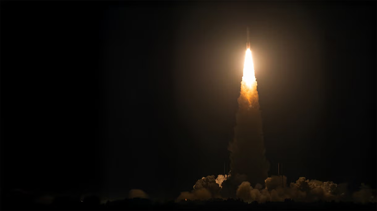
The L3Harris-built Navigation Technology Satellite-3 (NTS-3) satellite launched on a United Launch Alliance Vulcan rocket Aug. 12 from Cape Canaveral Space Force Station. NTS-3 will be used for a variety of experiments to include testing on-orbit, next-generation technologies that assist warfighters in contested environments. (L3Harris photo.)
WASHINGTON, DC – JULY 15: Sen. Maggie Hassan (D-NH) gives a statement after a policy luncheon with Democratic senators at the U.S. Capitol on July 15, 2025 in Washington, DC. (Photo by Michael M. Santiago/Getty Images)
Sen. Maggie Hassan told DefenseScoop that she aims to help “lay the groundwork for the next generation of position, navigation, and timing systems that will keep us…
White Sands, N.M. (February 09, 2020) — Naval Information Warfare Center (NIWC) Atlantic engineers travelled to New Mexico to validated M-code on Joint Light Tactical Vehicle test platforms like the ones pictured here, resulting in the Marine Corps obtaining U.S. Space Force certification for next-generation GPS technology. (U.S. Navy photo by Joe Bullinger/Released)
1st Space Brigade soldiers observe a U.S. Army Ranger raid during a large-scale combat scenario at the U.S. Army Special Operations Command Capabilities Exercise 2024 at Fort Liberty, North Carolina, April 5-12, 2024. The exercise demonstrated how Army space operations integrate with cyber and special operation forces partners to enable the warfighter on the ground. (U.S. Army photo by Brooke Nevins)
Special operators conduct training in austere conditions at Pituffik Space Base, Greenland, on May 9, 2023, in support of exercise ARCTIC EDGE 2023. (U.S. Army photo by Sgt. Andrew Adams)